
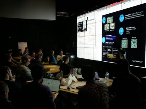
Recently, over 50 students – 17 of them from CSE – showed up for the day-long Big Pixel Hackathon organized by the Qualcomm Institute's Big Pixel Initiative (BPI) to showcase what can happen when you let students loose on the largest private collection of high-resolution satellite imagery on earth. The three interdisciplinary winning teams each had at least one member from the CSE department, and students tackled subjects ranging from urban slums and natural disasters to human traficking and illegal fishing.
UC San Diego is one of only two universities offered free access to the entire DigitalGlobe Basemap archive for one year. In addition to nine faculty projects approved so far, the BPI staged a May 23 hackathon that was unlike most hackathons. The teams were not asked to come up with a finished app or clean-cut solution, but rather, to ask big policy questions that might be addressed with satellite imagery that is accurate down to a resolution of half a meter (about 16 inches). Depending on the research question resolved by each team, they were given access to download specific image tiles from the earth database, covering areas including Tijuana and San Diego, French Polynesia, Gujarat and Mumbai in India, oil and gas regions in Texas and Alberta, Canada, Brazil, and so on.
CSE’s graduate and undergraduate students accounted for the largest number in the hackathon. The next largest contingent after CSE's 17 came from Economics, with eight students. The hackathon distributed $1,500 in cash prizes to the 13 members of the three winning teams.
In the first category, teams competed to come up with the Best Research Question. The diverse group included CSE sophomore Liz Izhikevich. The team looked at whether satellite images can help predict the impact of small-scale fisheries on the environment. The team came up with a neat computer vision-based solution for detecting hotspots of activity by small fishing boats, often in places where fishing is supposed to be restricted.
The Most Compelling Visualization/Strategy award went to a five-member team including CSE Master's student Dev Agarwal. The team set out to track unregistered (i.e., possibly illegitimate) global sea traffic. In principle, this would include the identification of ships carrying migrants (they showed one example of a ship in the Mediterranean crowded with passengers – visible even from a satellite in space).
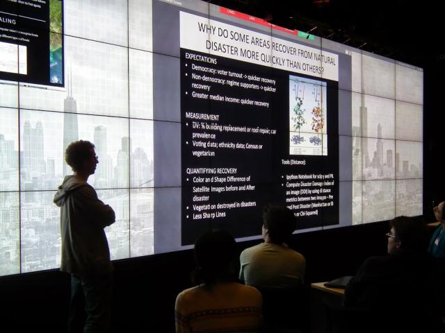 Finally, the prize for Most Insightful Discovery went to a team including graduating senior Kevin Hung, a double major in CSE and Mathematics (who is also co-founder of the relatively new Data Science Student Society at UC San Diego). Hung and colleagues asked why some areas recover from natural disaster more quickly than others. The team looked at before-and-after satellite images for differences in color and shape, particularly focusing on the rate at which vegetation grows back. Looking at satellite images of hard-hit Tacloban City before and after Typhoon Haiyan battered the Philippines in November 2013, they came up with a “compute disaster damage” index applied to the before-and-after images. They also looked at other factors that are likely to have an impact on the speed of recovery, ranging from median incomes (which spell faster recovery) to census data.
On June 17-18, experts from the Big Pixel Initiative including Jessica Block and Ran Goldblatt will visit Digital Globe headquarters in Colorado Springs, CO, to deliver a preliminary report on the UCSD projects that are using Basemap imagery. By next March, Digital Globe will decide whether to continue, expand or disband the university's free access to the Basemap.
Read the full Qualcomm Institute news release.
Learn more about the Big Pixel Initiative.